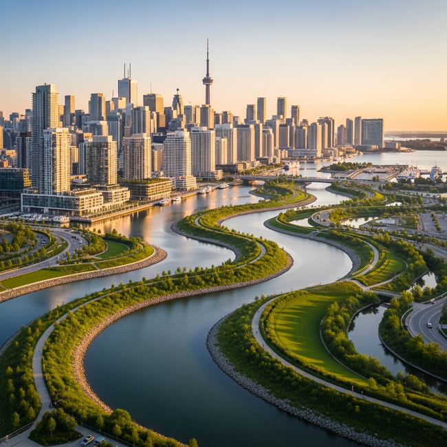
The transformation of Toronto’s Port Lands continues to reshape our city’s iconic view. A striking new photograph captured from the eastern reaches of Biidaasige Park highlights the evolving relationship between our urban core and the natural environment. The image features the downtown skyline framed by the newly constructed Commissioners Street bridge and the restored mouth of the Don River, where the city’s reflection serves as a testament to the massive infrastructure projects currently underway in the area.
As the Port Lands revitalization progresses, these major public works are not just improving flood protection and transit—they are fundamentally altering how we view the city. For those tracking the pulse of Toronto’s development, this visual milestone offers a fresh look at one of the most significant urban renewal projects in North America. To view the full high-resolution image and see more community-contributed photography, visit the original article on UrbanToronto.
Source: Read the original article